Essem has been associated with Oil Industries in India in providing geophysical application Software and Services to oil industries since 1996. It has experience in understanding the requirement of Oil and Gas Industry and transfers this information to real time achievement. We are always in the forefront to provide the latest technology to E&P Companies to reduce the exploration risk and time and hence associated with number of overseas companies for delivering state-of-art technology and software solutions to both downstream and upstream of the hydrocarbon exploration and production industry along with environmental solution to this industry.
The era of “easy oil” is behind us. However, like other sciences, geoscience is constantly advancing and refining its understanding of how, where and when oil traps are formed. Geophysics exploration tools yields millions of data that are processed to recreate a 3D image of the subsurface. Sophisticated data acquisition methods and ever more powerful supercomputers are opening up horizons whose existence was unsuspected in the recent past.
We are now a one window solution to cater the needs of any exploration company right from the data processing, interpretation, reservoir characterization, enhanced oil recovery & production optimization at the exploration/production site.
Specialised Seismic Processing Software
This specialised seismic processing s/w has been preferred for imaging of Thrust zone/hilly terrain/varied topography data.
The unique features in its s/w packages offer both conventional and high end near-surface refraction solutions to handle a variety of near-surface challenges.In simple situations, conventional approaches ensure resolving high velocity contrasts and offer high-resolution solutions. In complex areas, conventional methods may be applied to derive a good initial velocity model, and then highend imaging technologies such as traveltime tomography or waveform tomography can be further applied to resolve additional detail. With the more accurate and sufficient near surface correction and velocity model, a successful pre-stack depth migration can be achieved. Sometimes, in areas with sparse seismic raypath, it can also add gravity information to run a joint inversion to create a more reliable near surface model.
Broadband Processing
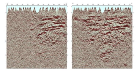
Experience in Broadband processing and have been used to improve the low frequency of the data through de-ghosting techniques.
VSP Processing,Survey Design Modelling and Visualisation
This software is available both in Windows as well as in Linux version. Some of the features are SEGY UTILITIES (2D and 3D), SIGNAL PROCESSING (2D and 3D), PICKER(2D and 3D), Interferometry (2D and 3D),Travel time (2D), Grid Model (2D),Tomography (2D), Migration (2D), VDCUBE (2D), CDP Stack (2D), Post process (2D and 3D), 3D Travel time, 3D Geometry Utilities, 3D Grid Model, 3D Model Utilities, 3D VSP Tomography, 3D VSP Migration,3D Model Update.
Powerful 2D/3D VSP and surface seismic survey design and modeling system makes completion of a variety of difficult jobs extremely efficient.
Integrated 3D VSP and surface seismic visualization and interpretation package. 3D VSP visualization integrated with the surface seismic solutions often involves multiple datasets with a large number of different types of property parameters.
Microseismic Processing
Microseismic processing offers capabilities for building simple and complex geologic models interactively, designing optimal microseismic monitoring geometry, processing data with user-defined workflows, imaging eventlocations with multiple techniques,visualizing and interpreting microseismic events in 3D.
HiFi PreStack Seismic Enhancement :
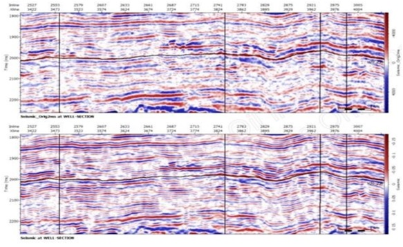
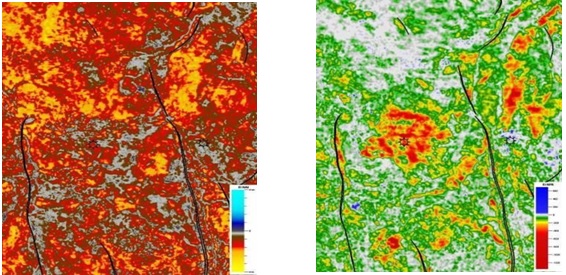
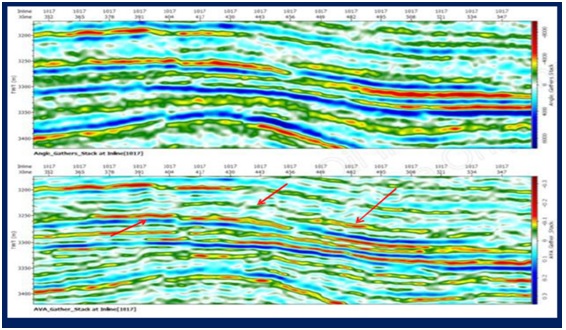
Enhancing seismic resolution is a constant challenge. There are number of technologies but it takes time and additional resource.We have introduced Hifi pre-stack seismic enhancement technology with significantly lower cost and a fast turnaround time. The process enhances the existing seismic gathers and calibrates them to well data.Calibration is in both frequency and amplitude resulting in seismic data with better well correlation, much improved resolution and optimized amplitudes for seismic reservoir characterization.
Thermo-Bar-Chemical (Enhanced Oil Recovery)
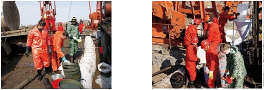
This technology allows us to extract the remaining recoverable 40 to 60 percent of oil and gas in the formation which are unrecoverable with the existing industry followed technology.
The main activity is to increase the completeness of extraction of hydrocarbons and increase the productivity of oil, gas and gas condensate wells through active (multi-stage ) pulsed thermal gas-chemical effects on the area drilling-redox mixtures and improve manufacturability data feed compositions in bottom zone treated wells.

Duplex Wave Migration Software
DWM is a complimentary process reinforcing Pre-Stack Depth Migration (PSDM) and is based on proprietary patented technology. It is great at displaying geologic structures displaying steeper than 60° angles. DWM in difference from Refracted wave migration do not require velocity model with considerable vertical gradient and big source – receiver offsets.
Why DWM is required
Conventional seismic imaging tools are capable of delineating moderate folding in which the reservoir cap rock has dips range from 0 to 45 degrees to form dome shaped closures that trap hydrocarbons. Many of these reservoirs have already been found, however, more structurally complex reservoirs that involve traps against near vertical faulting have yet to be found. Those play types can contain very large trapping systems; despite this many have not been explored because conventional seismic imaging methods are not capable of delineating these structures.
DWM technology allows reliably locating the vertical structures. Drilling for these targets is extremely risky and has largely been avoided in the past. With DWM technology, the geologist is given some direct evidence of the actual size and location of these near vertical structures and therefore the risk associated with the selection of the drilling location is significantly reduced.
Duplex Wave Migration is using and imaging diffracted waves and duplex waves, which are crucial in obtaining direct images of sub-vertical boundaries, including fracture zones, faults, the walls of salt domes, etc. Duplex waves are usually much stronger than the diffracted ones and for migrations based on the Kirchhoff integral, including migration 360 are considered as noise. In DWM,these waves are useful, carrying the main contribution to the image of sub-vertical boundaries
